New Trail Diversion Around Seepage Area

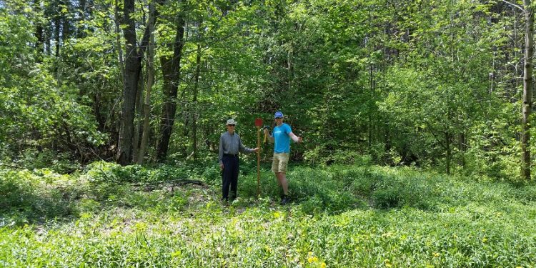
The Upland of the Copeland Forest is on the edge of the Oro Moraine.  Water seeps out of the hills and helps form the rivers that flow out of the Forest.

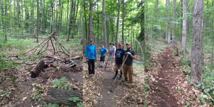
In a few instances, single track trails go through these water seepage areas and continued trail usage will lead to a widening of the trails and ecological damage.  At the end of June, six mountain bike members of Copeland Forest Friends Association re-routed 200 metres of trail to avoid one of the seepage areas.

It is our hope that this new route will discourage users from traveling through this sensitive area that is below the new trail.

Later this summer, we will add signs at either end asking users to stay on the trail.

Thanks to the trail crew for their hard work:  Bob, Tony, Ed, Brian, Kody, Johnathan and John.  A special thanks to Bob Hannah for coordinating the project.

Launch of 2016 Workplan

We have some exciting news that just came in.  The Copeland Forest Friends Association 2016 Work Plan has been approved by the Ministry of Natural Resources and Forestry.

The 2016 Work Plan is part of a three year plan focusing on trail management and ecology and sustainability.  The key objectives are to:

  1.  Support a sustainable network of trails to promote a broad range of safer recreational activities that respect the Forest.
  2. Use scientific research to monitor the Forest and undertake stewardship activities and develop educational opportunities.

This year the key projects include:

  1.  Development of a main trail map for the public – the map is set to go to the printers and will be available later in June.  One copy will be available free to members and additional copies will be $5.00.  Non-members may also purchase it at local stores.
  2. Development of directional and locator signage based on the map – there will be welcome signs going up at five parking lots, two on Ingram Rd and three on the 5th Line N.  Within the Forest, there will be 12 “You Are Here” signs with a map to show you where you are in the Forest.  Intersections on the dual track trails will be numbered and keyed to the map.
  3. Identification of sensitive ecological areas and installation of signage asking users to stay on the trails in these areas – Sensitive lichen and wildflower areas will be marked.
  4. Trail maintenance – pilot project for the 5th Line connecting trail.
  5. Trail re-routing for water seepage – two trail reroutes are proposed for single track trails going through seepage areas.

Stay tuned for news about the map and signage plans.  Requests will be going out to members for volunteers to help install the signs and work on the trails.  It’s going to be a busy and exciting time!

The signage project is being proudly supported by Casino Rama Resort.

Thanks to the board and the trails committee for all the work to develop this project

-David Kennedy, Copeland Forest Friends Board President.